In my last post I used a few Icelandic letters that I forgot to explain. To the very best of my ability I wanted to clarify a few common pronunciations (since I know all of you are going to do your very best in pronouncing the names of these magnificent waterfalls and quaint towns.)
- Þ (upper) and þ (lower) make the English “th” sound, this letter is generally used at the beginning of words. Like pronouncing Þór, or Thor.
- Ð (upper) and ð (lower) also make the English “th” sound, however no word will start with this letter and it is usually in the middle or end of a word. Like pronouncing fjöður, or feather.
- Æ (upper) and æ (lower) make the English hard “i” sound. A lot like saying hi! Hæ!
- Ö (upper) and ö (lower) make the German “ö” sound or the English “u” sound like in the word fur.
- J and j are pronounced like the English “y” like pronouncing já, or yes.
- R and r are pronounced like the Spanish rolled “r”.
- G and g are…difficult to explain so I’m going to copy and past from Wikipedia:
- like “g” in “good” at the beginning of a word, “k” in “wick” between a vowel and -l, -n; /ɣ/ after vowels, before a, u, ð, r, and when it’s the last character of a word; like “ch” in Scottish “loch” after vowels and before t, s; like “y” in “young” between vowel and -i, -j; dropped between a, á, ó, u, ú
- Lastly, linguists correct me if I’m wrong, there are stressed vowels such as Á, É, Í, Ó, Ú, and Ý versus their soft counterparts being A, E, I, O, U, and Y.
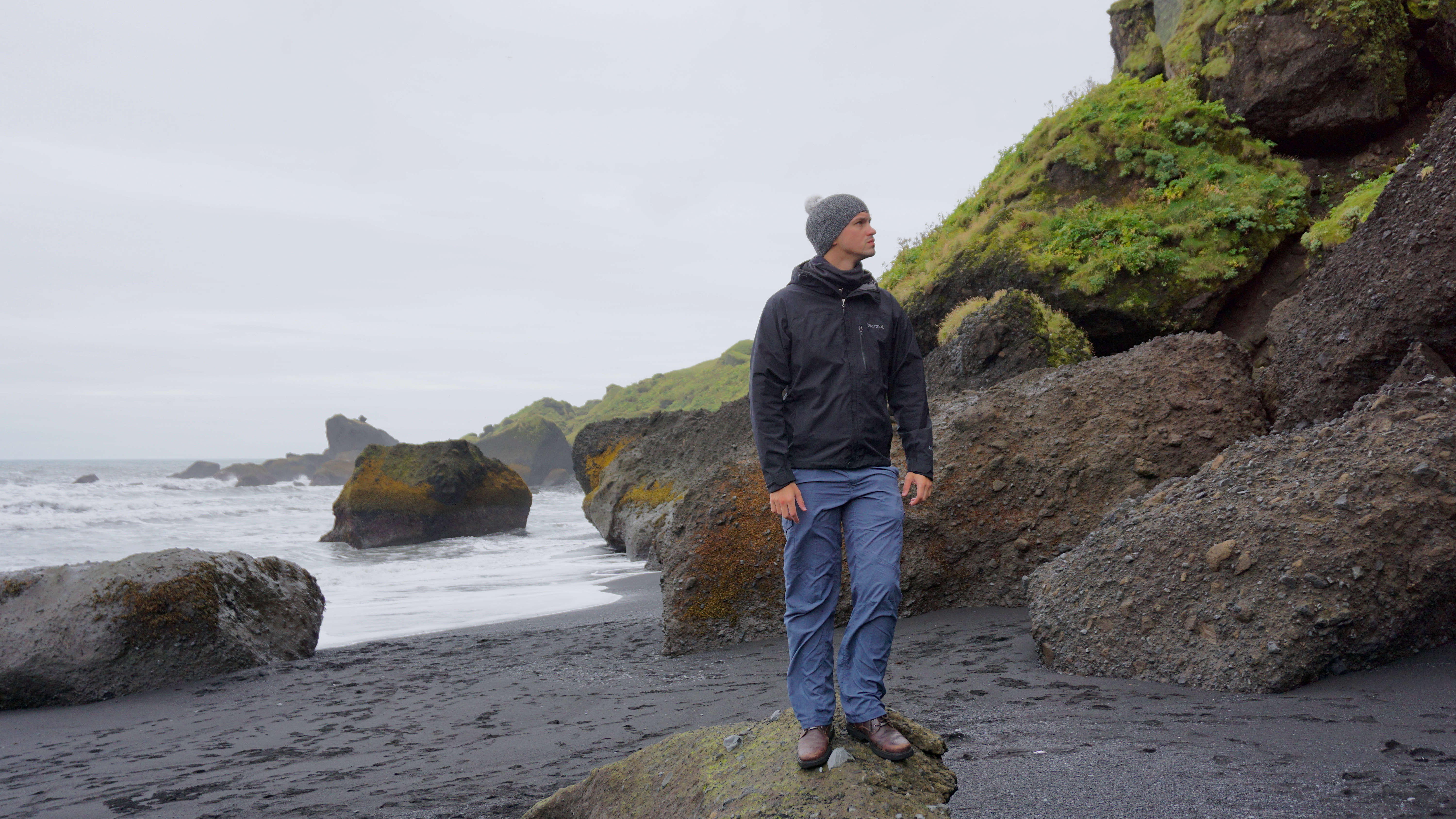
Forewarning, we did a whole lot this day. The following morning after waking up in Vík (there’s a stressed “i” in there), we drove five minutes down the street to our first black sanded beach. While walking it was so striking to see the drastic contrast of colors between the sand, the mountain ridges, the foliage, and the birds. 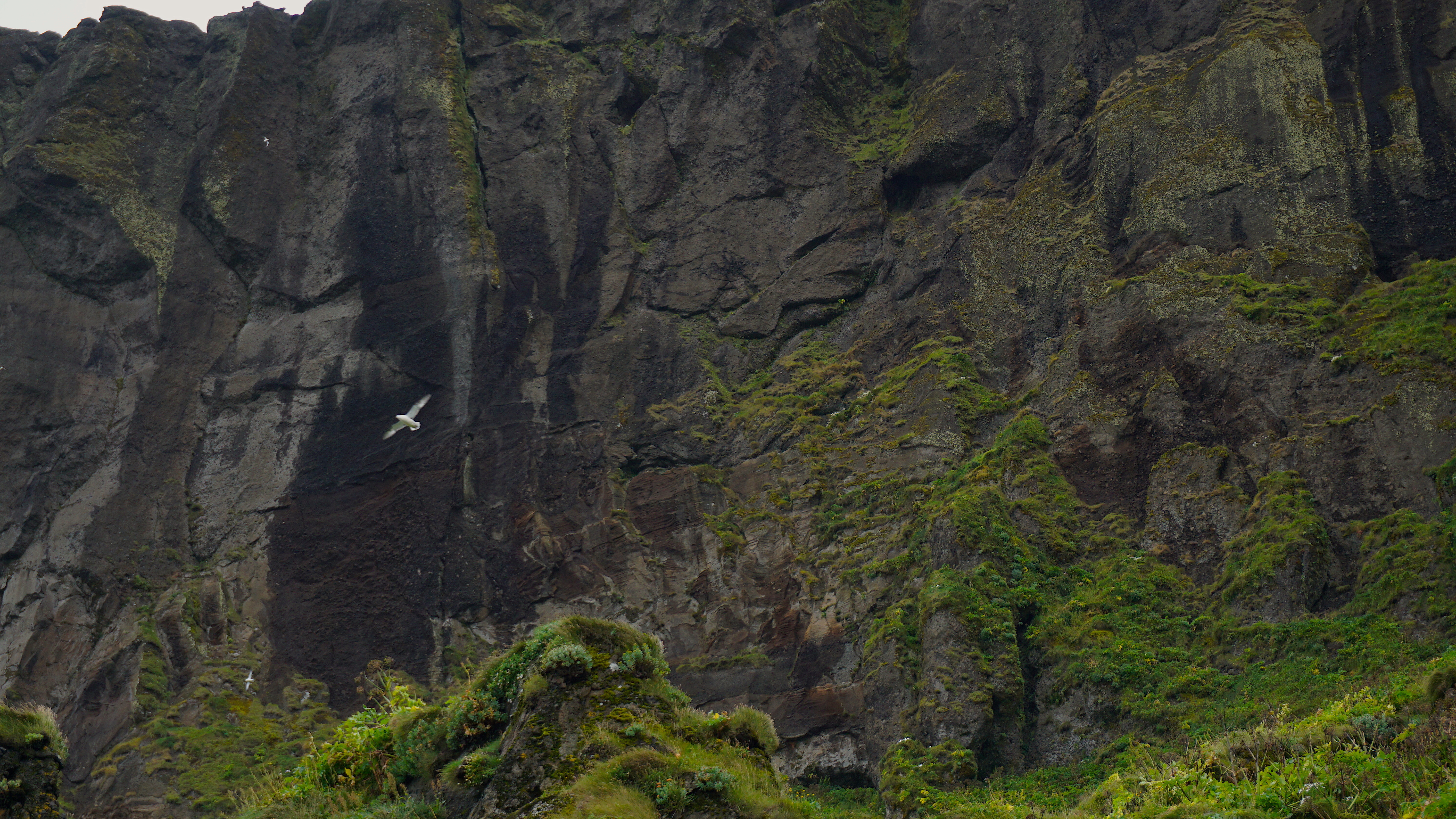
We snapped a few photographs then walked back to our vehicle to do some quick grocery shopping. We went to a Krónan, the first store we saw, to purchase some fruit, granola bars, and muffins to feed ourselves breakfast. It was also necessary to buy enough snacks to last us for the many hours of driving ahead. Groceries were extremely affordable, far cheaper than I expected and I’m grateful for it. As I continue to write I will likely stress that restaurant food, drinks, and FUEL are very expensive.
Before continuing east, the afternoon before we had passed (out of desperation to sleep) Skógafoss, the Sólheimasandur Plane Wreck, and Reynisfjara Beach. Skógafoss was too far back to simply backtrack at this time so we decided to catch it later when we were to go back west towards the peninsula. Driving back to Sólheimasandur however only took about 25 minutes, and Reynisfjara was even closer, therefore we chose the further point first. Once we reached the parking area of the plane wreck, we were confused. Despite other vehicles nearby, there was absolutely nothing around besides a long flat path on the beach. I was under the assumption that you could see the felled plane from the parking area, until I read a nearby sign that said that it was a 7km walk… Alas, we carried on, and walked for an hour and a half with many others that wanted to take photos of the plane, which was down a small slope in the vast distance.
Long story short, once we got to the plane, taking photos was a challenge. People were climbing all over the plane, taking a ton of time taking hundreds of photos in one spot or making a single pose. My girlfriend and I did our best to get decent shots with just each of us and the plane in them, maybe half were without people or within cropping range. For future reference I would advise going around dawn or dusk to avoid people to maximize the range of photographic viewpoints.
In 1973 the United States Navy were flying the DC3 plane over the south coast and it ran out of fuel causing it to crash on the black beach. Evidently the pilot made an error while flying and switched to the wrong fuel tank, a rather simple mistake. Everybody survived. Years ago people used to drive to the wreck, however this resulted in killing much vegetation, so the private landowner (yes, the plane is actually on private land, accessible at any time) decided to make a parking lot and a path instead to protect what little plant life is left out there.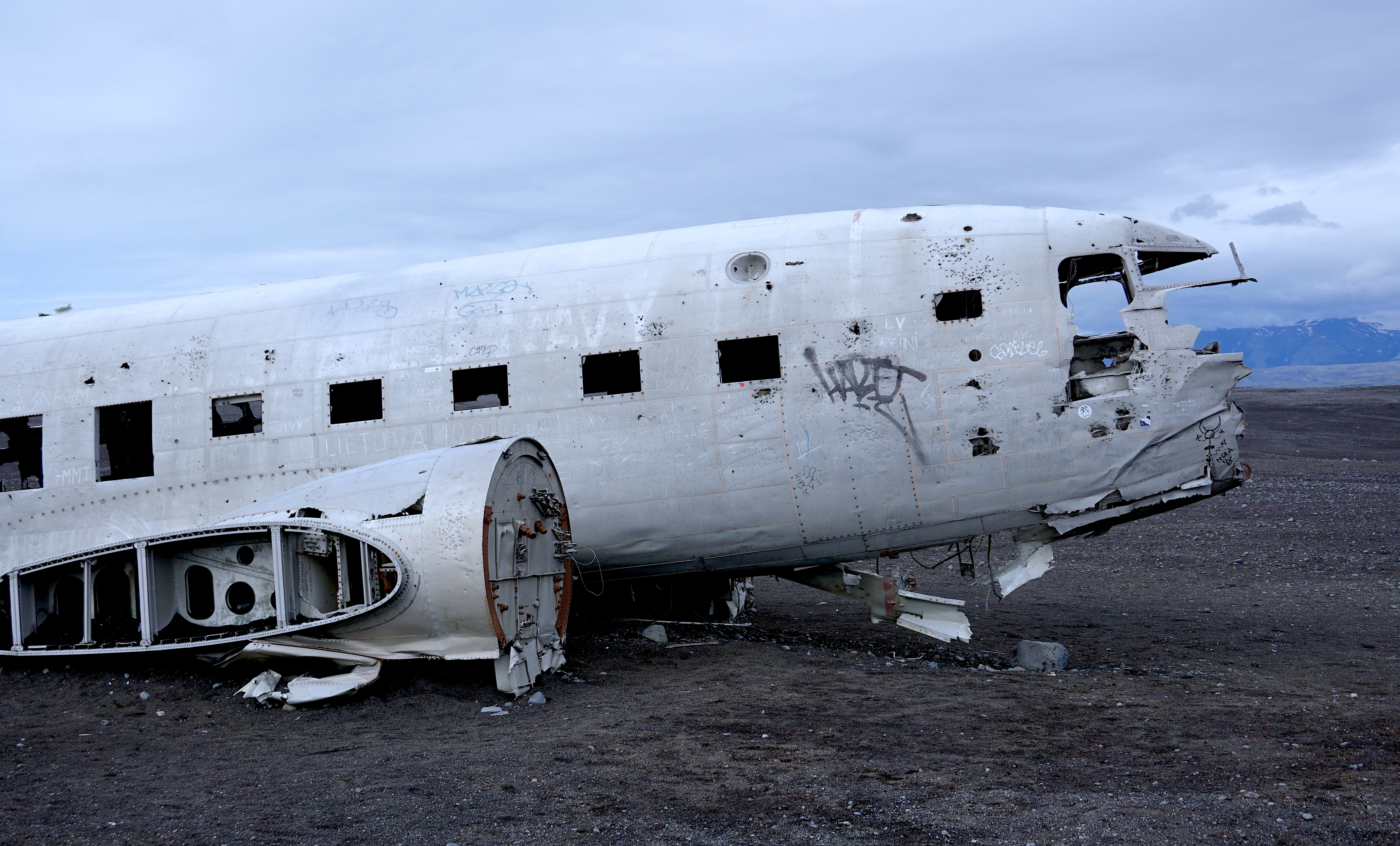
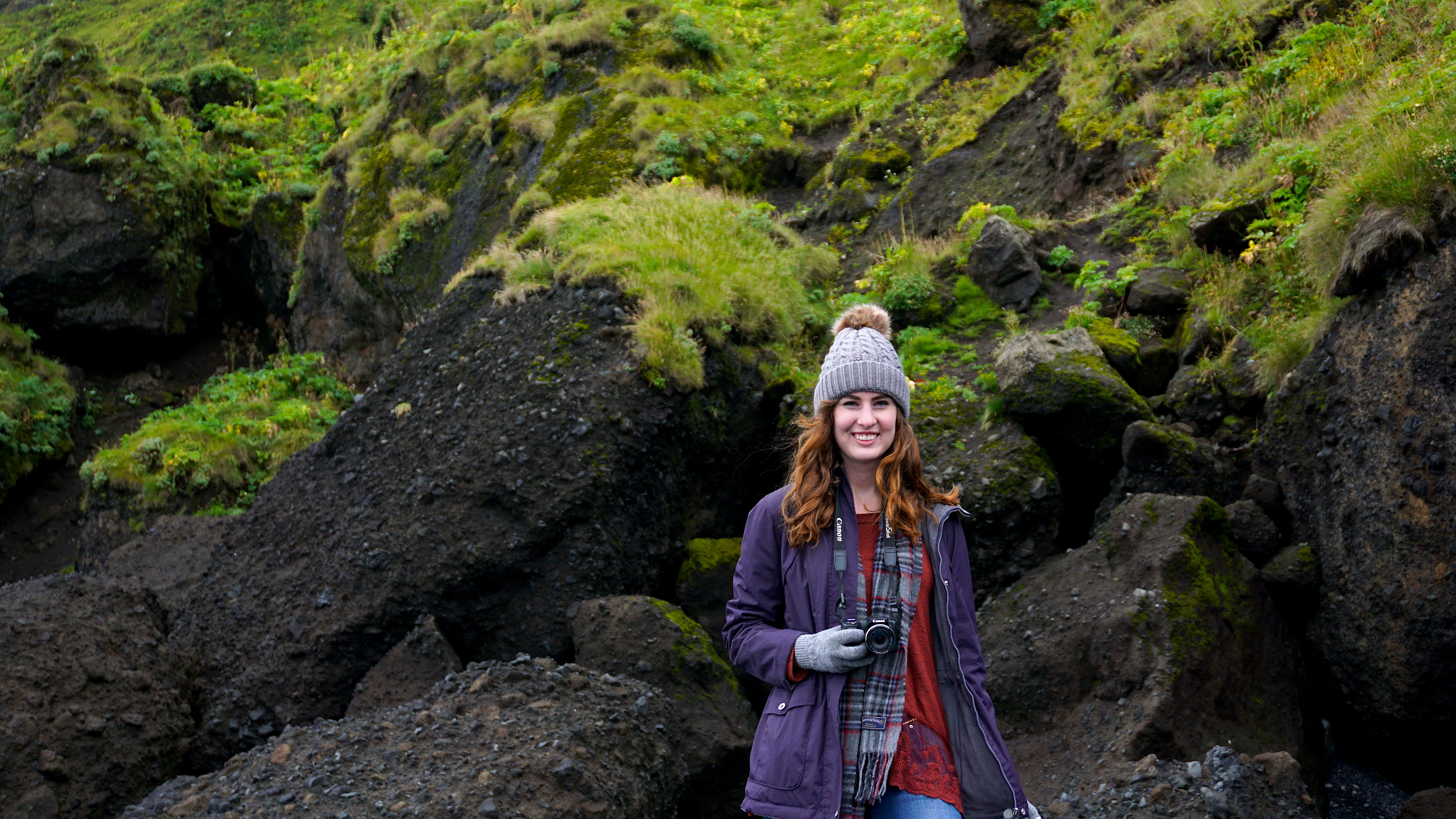
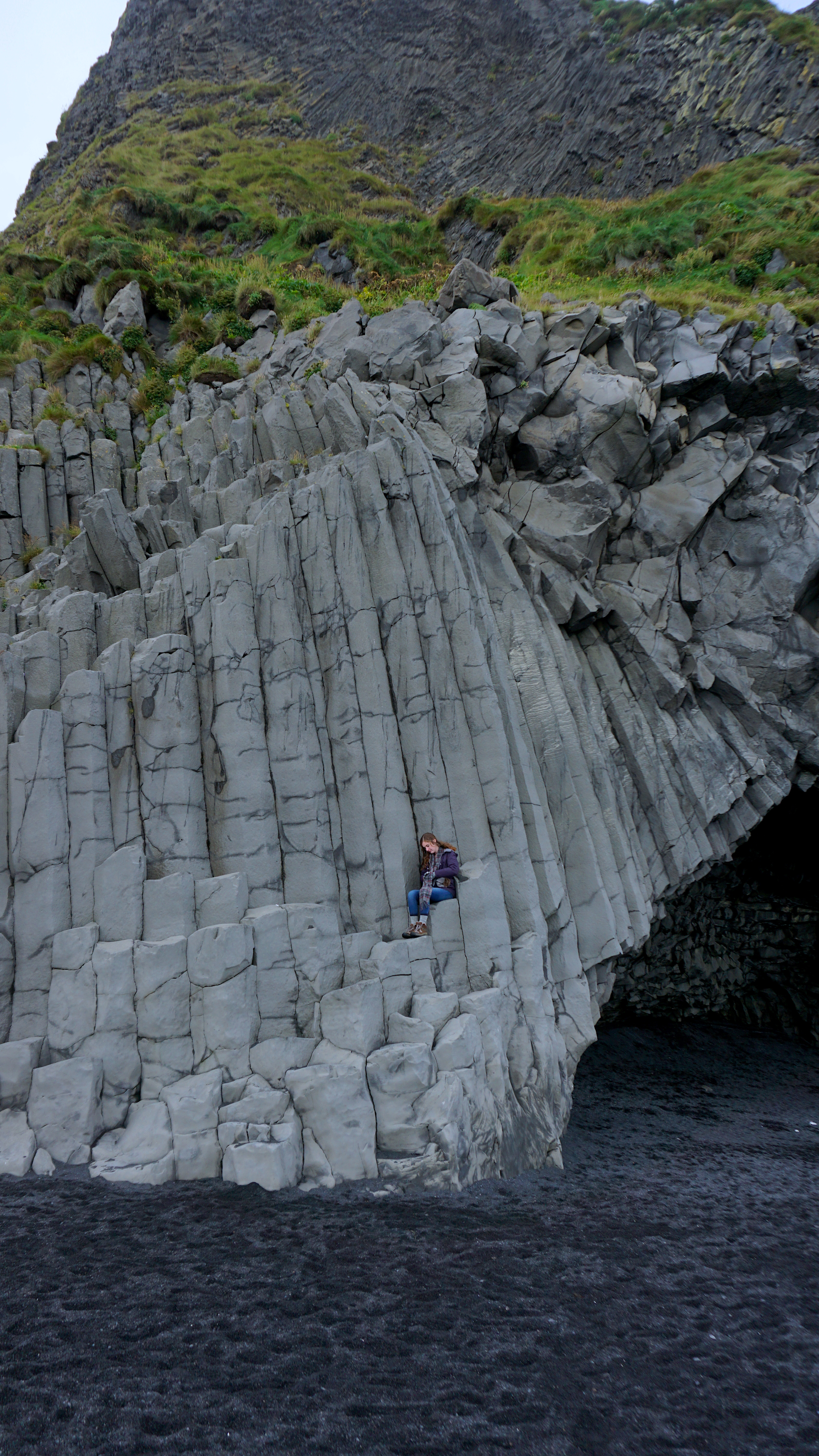
After making the long trek back to the SUV, we drove towards Reynisfjara. We parked along the busy road that led to the beach and strode onwards. Even from a distance we could see the towering basalt columns that made this place famous. I specifically have recognized this location from the show Sense8, Rogue One: A Star Wars Story, Star Trek: Into Darkness, and Bon Iver’s music video for “Holocene”.
Side note: Iceland is very popular for film and television. More things were shot all over this glorious country than you think. Parts of Interstellar, Thor: The Dark World, Lara Croft: Tomb Raider, Oblivion, The Secret Life of Walter Mitty, Prometheus, Batman Begins, Noah, and so on.
The basalt columns along the beach are volcanic wonders that are hexagonal in shape due to the cooling and contracting of lava in an equally spaced area. This little diagram below can visualize it better than I can type it, I’m no geologist though I find the subject interesting. Once again we played the game of trying to take good photos while dodging other tourists at this popular site.

Looking up, flying swiftly through the air we finally caught a glimpse of one of the things we were dying to see in Iceland…puffins! We arrived towards the end of puffin season and were concerned we would miss them but thankfully we caught them in Reynisfjara. The small birds raced back and forth between the sky and their burrows in the tall grasses above the basalt columns. We had never seen these adorable birds before and were absolutely fascinated by them. They humorously resembled small flying penguins. Their brightly colored beaks and crisp coloring on their heads were beautiful and made for quite the contrast to the rest of the seagulls.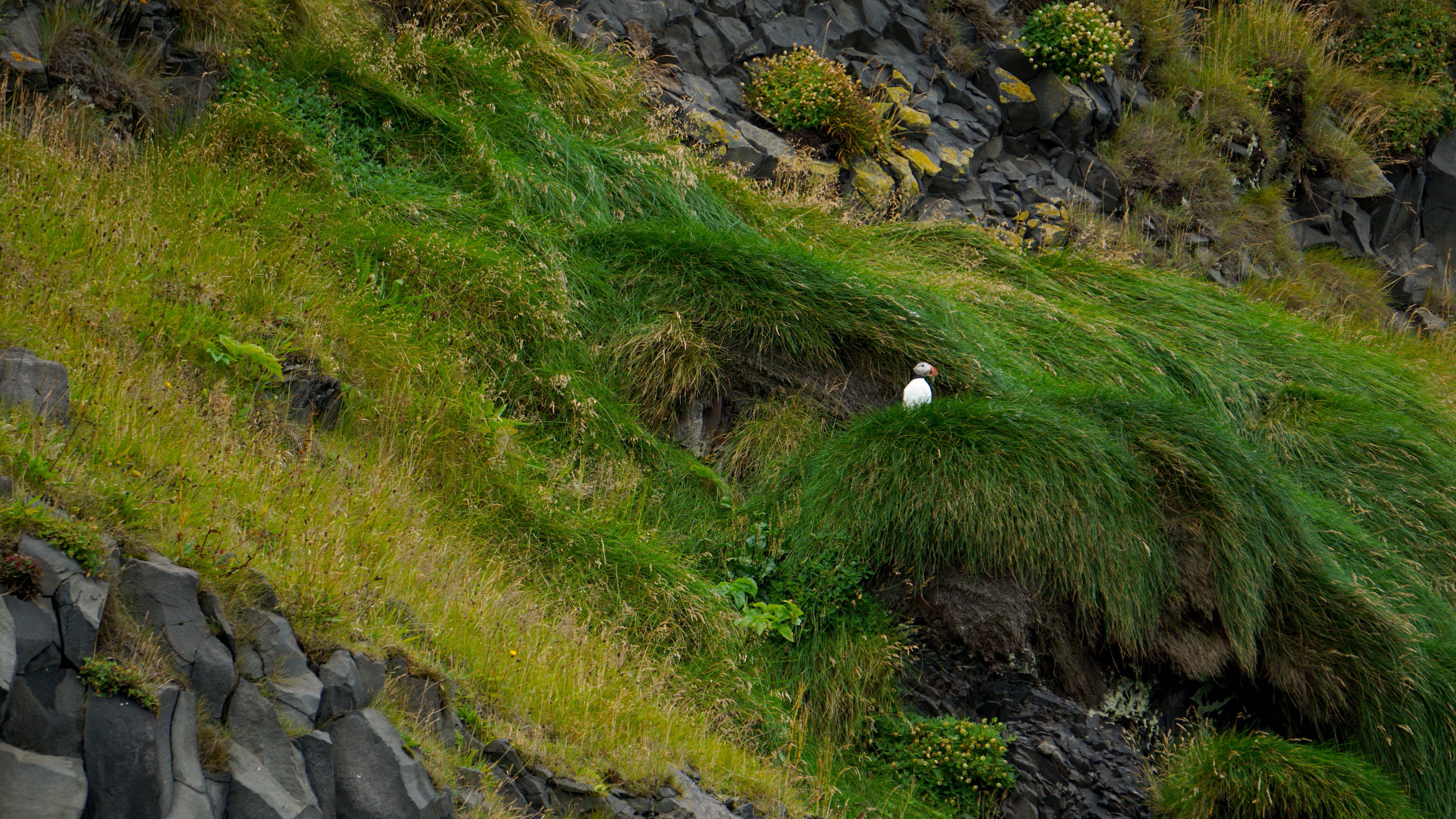
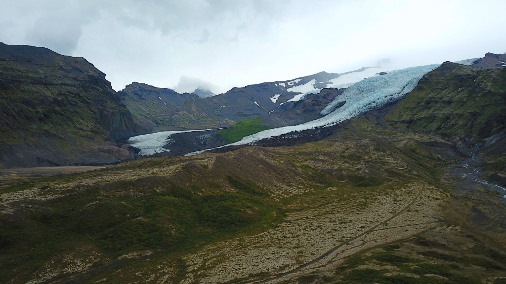
Soon it was time to carry on towards our farthest destination to the east, Diamond Beach. Once we drove through Vík for the second time we saw a mountain towards the south with a sign that said Hjörleifshöfði and a sand road that trailed past it. We pulled onto the path and drove the short distance to the base of the mountain. For the first time since we arrived in Iceland, we were totally alone. There was not another vehicle around, no birds either at the moment.
We found another sign at the base of the mountain that provided two trail maps to the peak. Hjörleifshöfði is a site of the first Viking grave in Iceland from the year 875. Only a year before in 874, Hjörleifur Hróðmarssonur and his blood brother Ingólfur Arnarson arrived in Iceland after splitting up to discover different lands across the country. Hjörleifur wintered in Hjörleifshöfði only for he and his men to be killed by his slaves the following spring. The slaves then fled with all of the women to the Westman Islands just south of the Iceland mainland. Ingólfur later discovered his deceased brother and immediately set sail to the Westman Islands, slaughtering all of the slaves that killed Hjörleifur. On top of the mountain lies Hjörleifur’s Grave which is where he is believed to be buried.
Time somewhat stood still here. For me personally, there was a somber feeling in the air. I only snapped a couple photos, almost out of respect. Although time stood still, time was not on our side, we did not get to ascend the mountain all the way to see the mound of rocks that Hjörleifur is said to be buried beneath, but I do plan to make a return trip with this hike as a top priority. I highly recommend going here and experiencing such a surreal feeling of isolation and wonder.
As we drove for the next couple hours, we became hungry and searched for any restaurant to be open, although it was after 6pm and nearly nowhere was open… Thankful as ever to have an international phone plan at the time, we backtracked 20 minutes to find the only open gas station along the Ring Road (for many kilometers) that closed at 7:15pm or some obscure time like that. I had noticed that most gas stations in Iceland have actual small restaurants within them and occasionally bars as well, both of which were greatly appreciated after driving for several hours, even if it made my wallet hurt afterwards.
Finally, after eating and driving hundreds of kilometers, we reached our last destination of the day, Jökulsárlón. Jökulsárlón is a glacial lagoon that lies on the very edge of Vatnajökull National Park. As Icelandic drone laws go, I could not fly my drone here, but some of the photos captured here are incredible. Not to mention there were seals in the lagoon! I don’t have any good photos of them because they were fast and looking for food, but I will certainly include them in the Iceland video at the end of this blog series.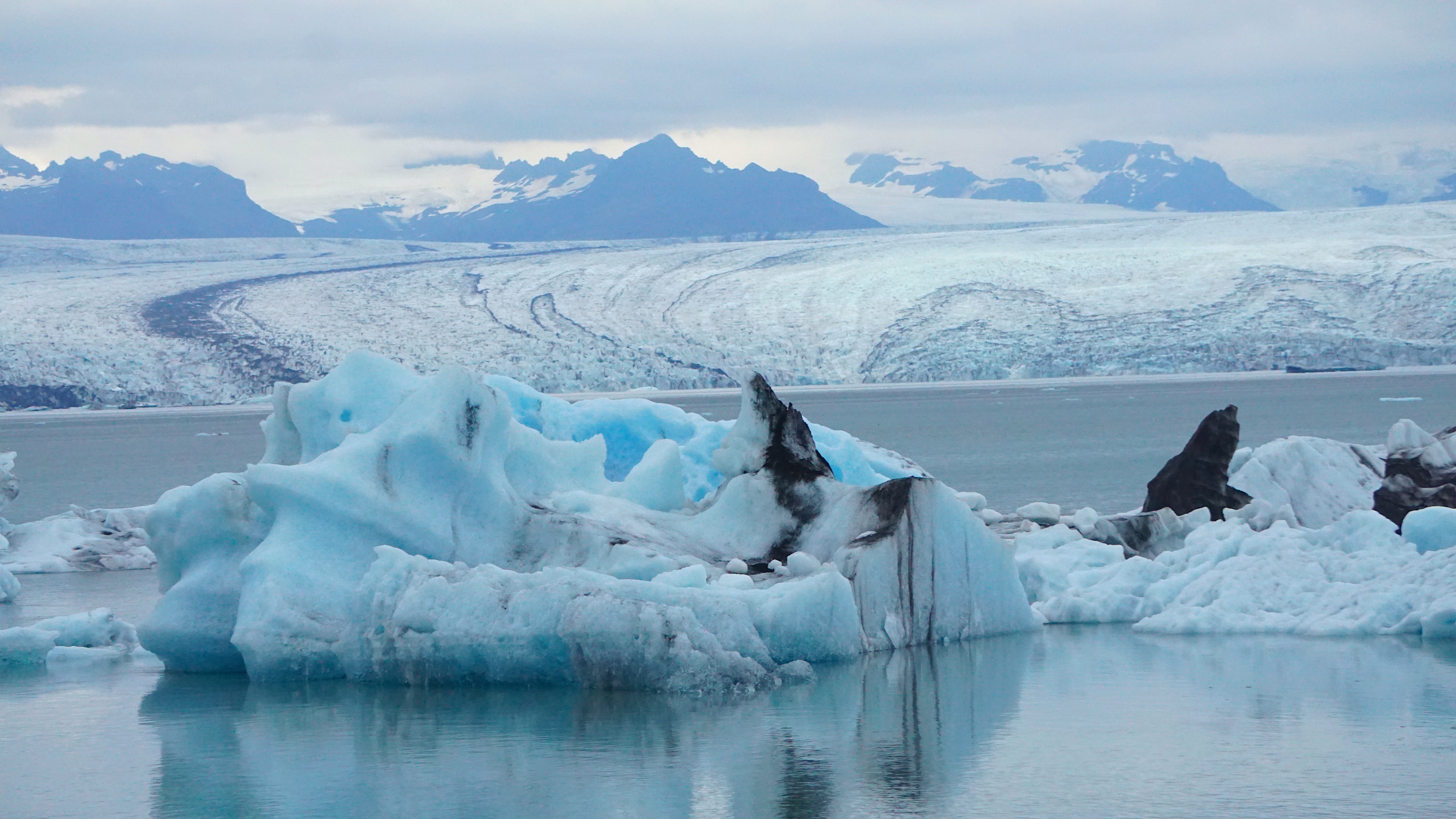
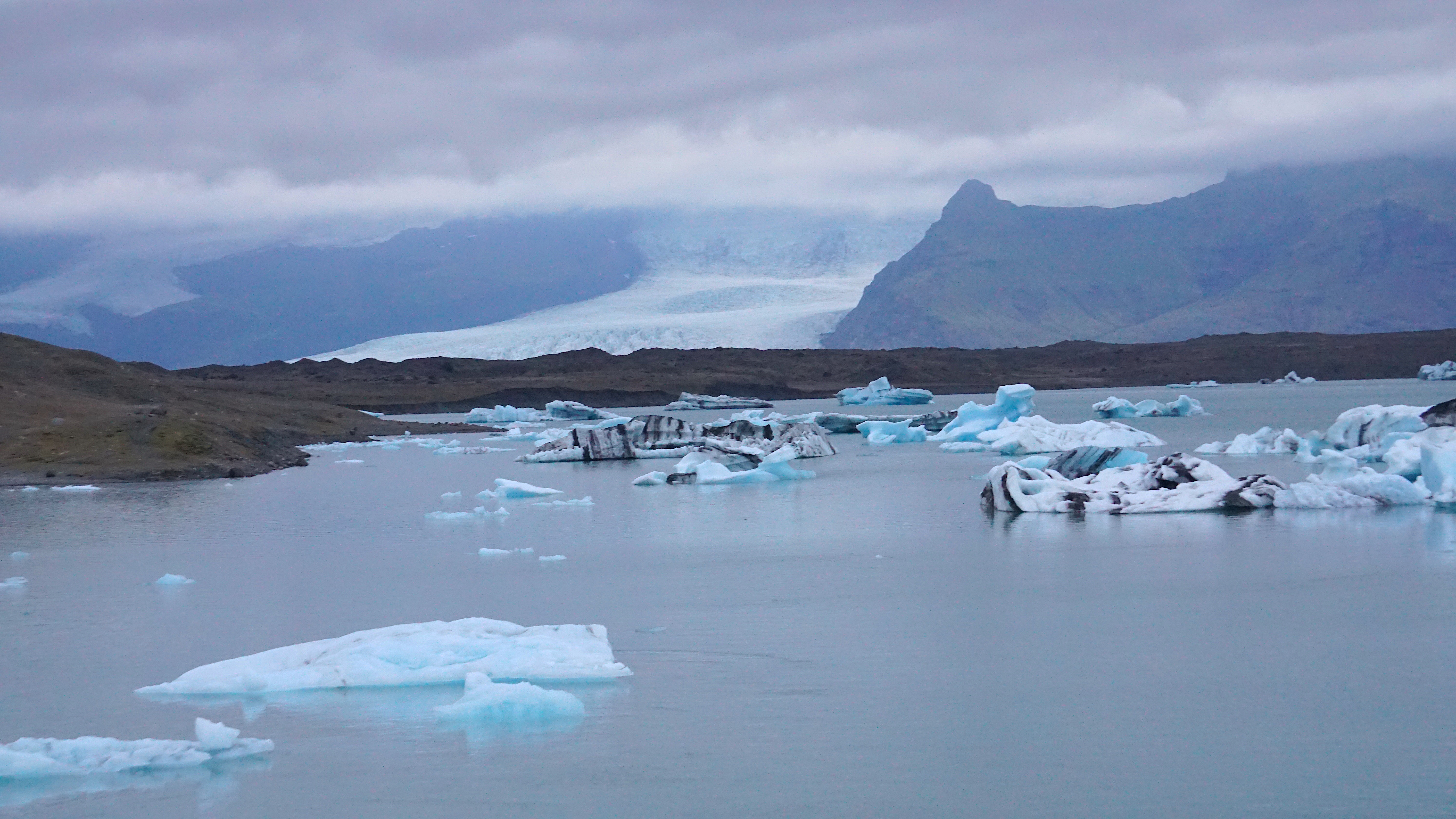
During the summertime in Iceland, the sun just barely sets beneath the horizon. These photos were taken around 10pm I want to say, so shortly after the lagoon got pretty dark and we were off to find somewhere to sleep. Or so we thought. It was my error that I thought there was camping nearby Jökulsárlón, turns out there was not! Originally I thought there was a campsite nearby but learned that the next place to set camp was another 30 minutes along the Ring Road going eastbound. We didn’t want to continue going in that direction when we were at the farthest point east that we planned to go, so we settled for quite a bit less. If any Icelandic park rangers ever read this, I apologize in advance. We ended up parking our car in one of the small lots along the hills that separate the road from the glacial lagoon and illegally slept in our vehicle that night. The back seats in the Mitsubishi SUV did not fall completely flat, so when we slept in the trunk our bodies laid upon an incline, therefore we had probably the most uncomfortable sleep ever that night. The next morning, we left no trace of being there.

Leave a reply to mirymalu Cancel reply